Flurry of tornado activity reported across Manitoba
A flurry of tornado activity was reported throughout southern Manitoba on Wednesday night.
According to Environment and Climate Change Canada (ECCC), a low pressure system moving in from Saskatchewan triggered tornado warnings at around 3:30 p.m. for areas around Binscarth, Man.
“That storm actually tracked over the next three hours all the way down to the Morden and Winkler area, and we had multiple reports of tornadoes along the way,” said ECCC meteorologist Dan Fulton.
Over the next few hours, tornado touchdowns were reported in Rapid City, Rivers, Cypress River, Baldur, and Swan Lake.
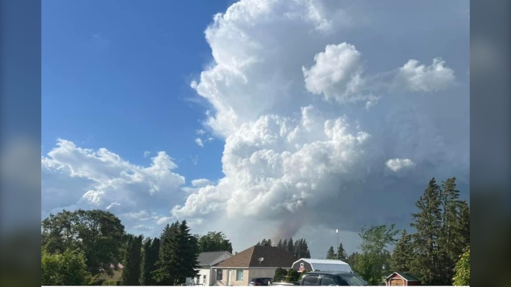 Witnesses say a tornado touched down between Mariapolis and Saint Alphonse, Man. then turned southeast into Swan Lake First Nation. (Submitted photo: Justin DeBaets)
Reports about tornado activity in other regions could still come in, he said.
Additionally, the Northern Tornadoes Project will investigate over the next few days, and assign a rating to the tornadoes.
“They weren’t really monsters. They weren’t the kind of big wedge tornadoes you see in the States,” Fulton said.
In addition to the fast and furious winds, toonie and golf ball sized hail were reported.
Precipitation amounts weren’t very high, with much of southern Manitoba seeing about 12 millimetres worth of rainfall, while two millimetres were reported at the Winnipeg Richardson International Airport and only one at The Forks.
The system has since moved into North Dakota, Fulton said.
While much of the south still has a chance of thunderstorm activity Thursday, he says there’s a lot less energy associated with this system.
“We’re not expecting the same kind of stuff that we saw yesterday. They should be non-severe today.”
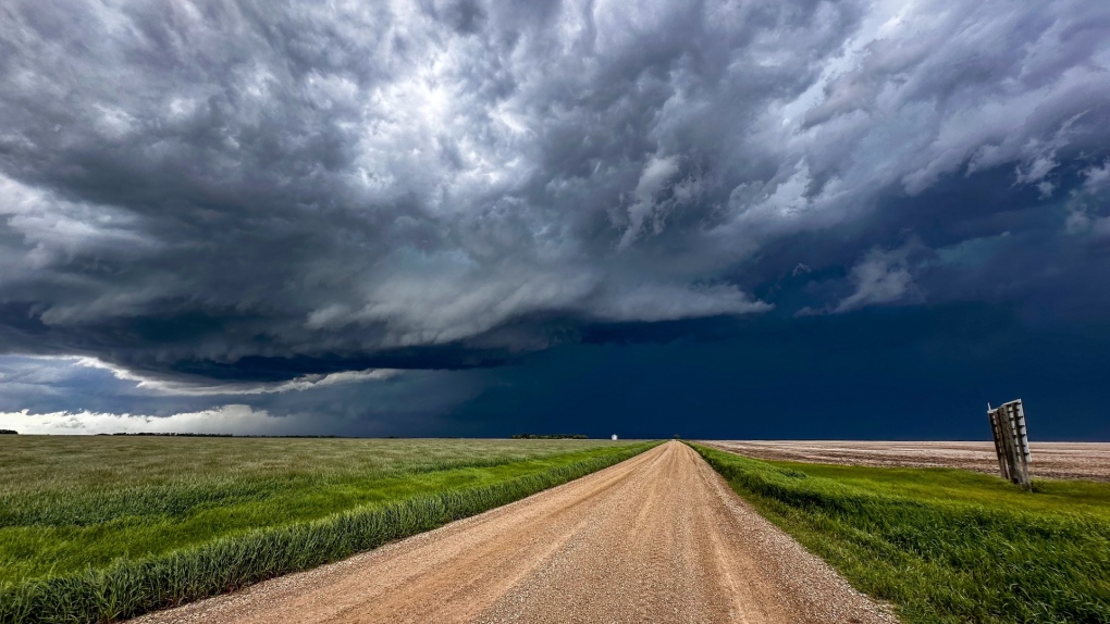 Severe weather rolling through western Manitoba near Brandon on June 12, 2024. (Submitted photo: Terry)
View original article here Source

CLIF BAR - Energy Bars - White Chocolate Macadamia Flavour - (68 Gram Protein Bars, 12 Count) Packaging May Vary
$15.00 (as of September 7, 2024 14:54 GMT -05:00 - More infoProduct prices and availability are accurate as of the date/time indicated and are subject to change. Any price and availability information displayed on [relevant Amazon Site(s), as applicable] at the time of purchase will apply to the purchase of this product.)
Samsung Galaxy S22 (5G) 128GB Unlocked - Phantom Black (Renewed)
$329.10 (as of September 7, 2024 14:54 GMT -05:00 - More infoProduct prices and availability are accurate as of the date/time indicated and are subject to change. Any price and availability information displayed on [relevant Amazon Site(s), as applicable] at the time of purchase will apply to the purchase of this product.)
Queen Size 4 Piece Sheet Set - Comfy Breathable & Cooling Sheets - Hotel Luxury Bed Sheets for Women & Men - Deep Pockets, Easy-Fit, Extra Soft & Wrinkle Free Sheets - White Oeko-Tex Bed Sheet Set
$29.99 (as of September 7, 2024 14:54 GMT -05:00 - More infoProduct prices and availability are accurate as of the date/time indicated and are subject to change. Any price and availability information displayed on [relevant Amazon Site(s), as applicable] at the time of purchase will apply to the purchase of this product.)
BLACK+DECKER 2-in-1 Rice Cooker & Food Steamer - 6-Cup Capacity, Automatic Keep Warm, Nonstick Bowl, Steaming Basket - Effortless Cooking
$19.98 (as of September 7, 2024 14:54 GMT -05:00 - More infoProduct prices and availability are accurate as of the date/time indicated and are subject to change. Any price and availability information displayed on [relevant Amazon Site(s), as applicable] at the time of purchase will apply to the purchase of this product.)