Winter weather warnings still looming throughout Manitoba
Central and southern Manitoba remain under an array of weather alerts on Sunday.
Environment and Climate Change Canada (ECCC) has issued blizzard warnings for parts of southwestern Manitoba as a low-pressure system sweeps across the province.
“A Montana low will bring snow and blowing snow to the region beginning Sunday morning. As the system strengthens during the morning hours, snowfall rates and wind speeds will increase creating blizzard conditions,” ECCC said in an online alert.
The following areas fall under the blizzard warning:
• Brandon – Neepawa – Carberry – Treherne
• Dauphin – Russell – Roblin – Winnipegosis
• Killarney – Pilot Mound – Manitou
• Melita – Boissevain – Turtle Mountain Provincial Park
• Minnedosa – Riding Mountain National Park
• Ste. Rose – McCreary – Alonsa – Gladstone
• Virden – Souris
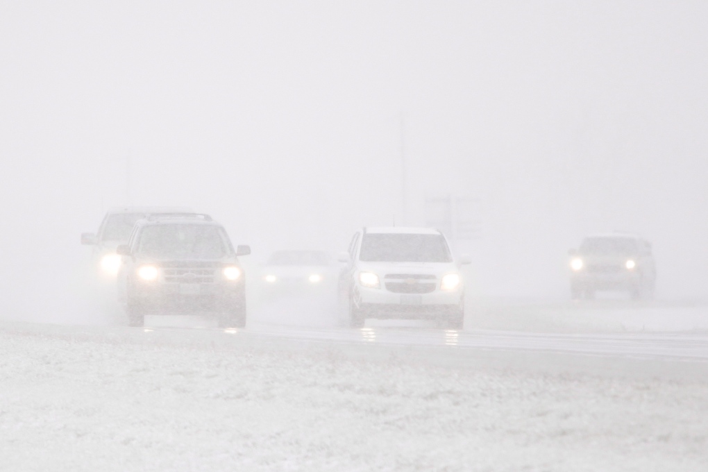
ECCC said the region could see between 25 and 35 centimetres of snow. The heavy snowfall, paired with 80-kilometre-per-hour winds, is expected to create “near-zero” visibility conditions.
“Blizzard conditions will improve Sunday evening as wind speeds weaken but heavy snow will continue through to Monday morning,” ECCC said.
ECCC is warning rapidly accumulating snow and visibility could make travel “very difficult or impossible” and road closures are likely. The weather agency is asking motorists to consider postponing non-essential travel until conditions improve.
Meantime, other parts of the region are under a winter storm warning, including:
• Arborg – Hecla – Fisher River – Gypsumville – Ashern
• Grand Rapids – Waterhen
• Portage la Prairie – Headingley – Brunkild – Carman
• Selkirk – Gimli – Stonewall – Woodlands
• Swan River – Duck Mountain – Porcupine Provincial Forest
ECCC said these areas are expected to see heavy snowfall over the next day, but slightly less severe wind speeds.
The City of Winnipeg, along the with following areas, are under a freezing rain warning:
• Bissett – Victoria Beach – Nopiming Prov. Park – Pine Falls
• Dugald – Beausejour – Grand Beach
• Morden – Winkler – Altona – Morris
• Sprague – Northwest Angle Provincial Forest
• Steinbach – St. Adolphe – Emerson – Vita – Richer
• Whiteshell – Lac du Bonnet – Pinawa
“A low pressure system is bringing patchy freezing rain to parts of southern Manitoba Sunday morning. The risk of freezing rain will decrease into the evening when the precipitation changes to snow,” ECCC said in the alert.
The weather agency warns roadways may become icy and slippery, and poor conditions may lead to delays.
ECCC is also warning ice build-up could cause power outages.
Finally, snowfall warnings are in effect through central Manitoba:
• Berens River – Little Grand Rapids – Bloodvein – Atikaki
• Flin Flon – Cranberry Portage – Snow Lake
• Island Lake – Oxford House – Gods Lake
• Norway House – Cross Lake – Wabowden
• Poplar River
• The Pas – Wanless – Westray – Clearwater Lake Prov. Park
ECCC said these areas could see 10 to 15 centimetres of snow beginning Sunday evening.
A full list of weather alerts can be found on Environment and Climate Change Canada’s website.
View original article here Source

Bounty Select-A-Size Paper Towels, 8 Double Plus Rolls = 20 Regular Rolls, White
$21.98 (as of April 16, 2024 16:00 GMT -05:00 - More infoProduct prices and availability are accurate as of the date/time indicated and are subject to change. Any price and availability information displayed on [relevant Amazon Site(s), as applicable] at the time of purchase will apply to the purchase of this product.)
Brita Standard Water Filter, Standard Replacement Filters for Pitchers and Dispensers, BPA Free, 3 Count
$22.49 (as of April 16, 2024 16:00 GMT -05:00 - More infoProduct prices and availability are accurate as of the date/time indicated and are subject to change. Any price and availability information displayed on [relevant Amazon Site(s), as applicable] at the time of purchase will apply to the purchase of this product.)
Apple Watch SE (2nd Gen) (GPS + Cellular 44mm) Midnight Aluminium Case with Midnight Sport Band, Regular (Renewed)
$259.00 (as of April 16, 2024 16:00 GMT -05:00 - More infoProduct prices and availability are accurate as of the date/time indicated and are subject to change. Any price and availability information displayed on [relevant Amazon Site(s), as applicable] at the time of purchase will apply to the purchase of this product.)
BenSorts Women Men Pillow Sandals Adjustable Buckles Slides Thick Sole
$28.49 (as of April 16, 2024 16:00 GMT -05:00 - More infoProduct prices and availability are accurate as of the date/time indicated and are subject to change. Any price and availability information displayed on [relevant Amazon Site(s), as applicable] at the time of purchase will apply to the purchase of this product.)